


OKTAL-SE
OKTAL Synthetic Environment (OKTAL-SE), develops software for physics-based modeling and validation of electro-optical, infrared, radar, and GNSS sensors in complex 3D environments. SE-Workbench combines the full software chain—from terrain and material modeling to dynamic scenario design, high-fidelity sensor simulation, and real-time image generation—within one synthetic environment. Used across defense, aerospace, space, transportation, and sensor-development programs, this approach enables design decisions to be evaluated reproducibly under different atmospheric and mission conditions. TARGET A.Ş. is the local point of contact in Türkiye for technical assessment and project integration of OKTAL-SE solutions.
Combines terrain, object, material, and atmospheric data within one synthetic environment for visible, infrared, and RF simulation.
Combines high-fidelity physics-based computation and real-time image generation within the same scenario and validation approach.
Supports evaluation of visible and infrared cameras, radar systems, and GNSS receivers under the same environmental conditions.
Three core software layers from 3D environment to sensor output.
OKTAL-SE brings physical environment creation, dynamic scenario preparation, and EO/RF sensor-output computation together in the SE-Workbench ecosystem.
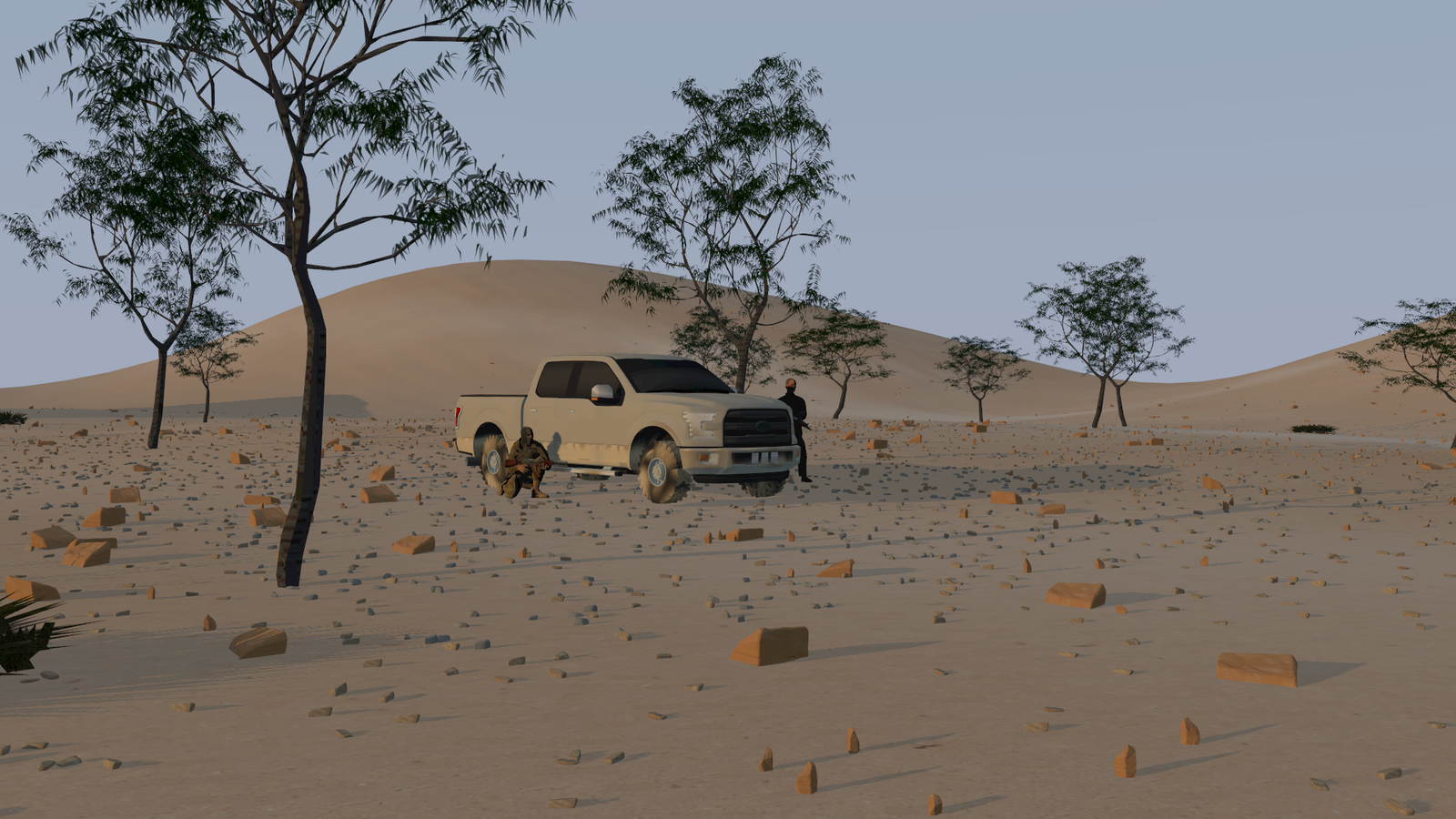
SE-AGETIM + SE-SCENARIO
Creates 3D environments enriched with physical properties from geospatial data and combines objects, sensors, and events in one dynamic scenario.
- Configurable terrain generation from GIS, cartographic data, and 3D models
- Physical material properties for EO and RF computation
- Joint management of atmosphere, routes, sensors, and custom events
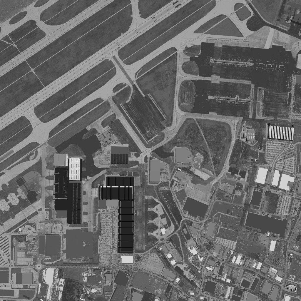
SE-RAY-IR + SE-FAST-IR
Provides integrated simulation from high-fidelity physics-based analysis to real-time sensor-image generation in visible and infrared bands.
- Spectral, physics-based ray tracing across 0.4–15 µm
- GPU-accelerated real-time infrared image generation
- Integration of optical, electronic, and platform effects into the sensor model
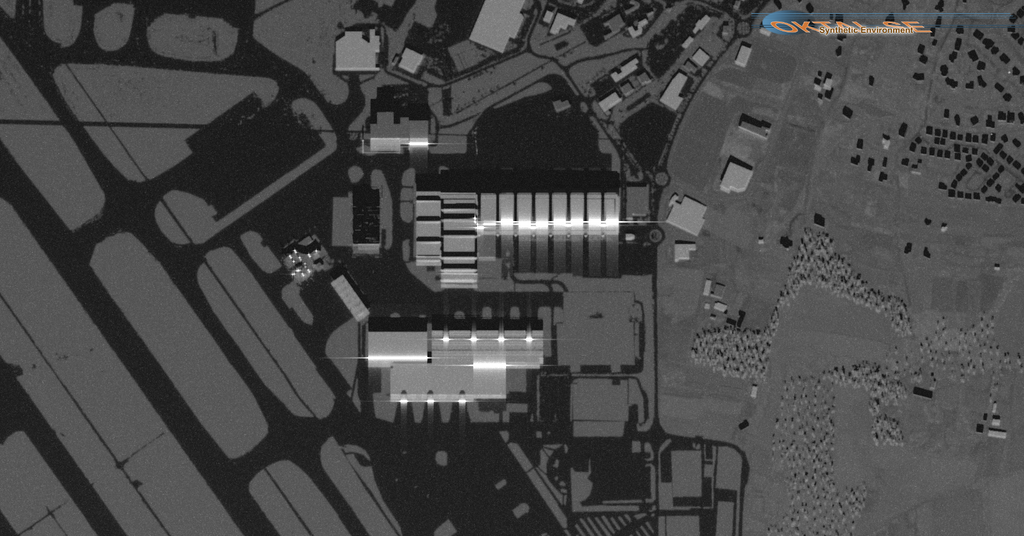
SE-WORKBENCH-RF
Supports RF-system design and validation through physics-based modeling of electromagnetic propagation and radar response in complex 3D environments.
- High-frequency electromagnetic propagation computation from 1–100 GHz
- EM field, SAR, ISAR, RBGM, MIMO, and GMTI applications
- Configurable operation through GUI, launcher, and C API
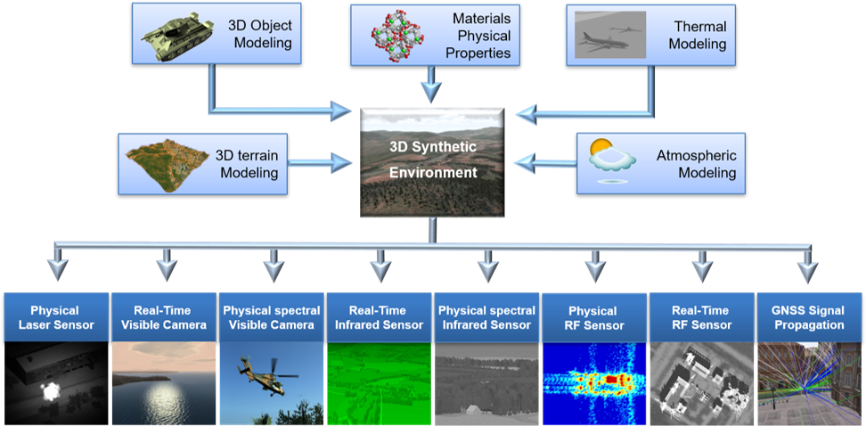
System approach
From the physical environment to validated sensor output.
01 / MODEL
Build the physical environment
Define terrain, 3D objects, and electro-optical or RF material properties within a shared synthetic environment.
02 / CONFIGURE
Configure the scenario
Combine atmosphere, thermal conditions, sensors, routes, moving objects, and dynamic events in one scenario.
03 / SIMULATE
Generate sensor output
Run the same environment across visible, infrared, and RF domains in real-time or high-fidelity computation modes.
04 / VALIDATE
Connect the results to the system
Reproduce comparable results with validation records and transfer them to HWIL, SWIL, or training applications.
Why OKTAL-SE?
SE-Workbench uses the same physical synthetic environment across multiple sensor domains, bringing design, development, and validation onto a shared data foundation.
One environment, multiple sensors
Visible, infrared, radar, and GNSS models can share the same geometry, material, atmosphere, and scenario data.
Physics-based and verifiable
Real-time results can be compared with high-fidelity physics-based computations and rerunnable validation data.
Open and modular integration
Graphical interfaces, launcher tools, and C API options simplify connecting SE-Workbench components to existing development and test infrastructure.
Physics-based EO/IR, radar, and GNSS sensor simulation
The OKTAL-SE software family integrates synthetic-environment generation, physical material definition, atmospheric and thermal conditions, dynamic scenario management, and sensor-image computation to examine sensor performance in complex 3D environments.
SE-Workbench-EO can evaluate visible and infrared sensors in high-fidelity or real-time modes. RF solutions support electromagnetic propagation, radar imaging, and antenna behavior, while GNSS solutions can assess receiver performance under restricted visibility and multipath conditions.
This architecture supports sensor design, algorithm development, technical comparison, system validation, training simulation, and hardware-in-the-loop testing on the same synthetic-data foundation.
Local engineering and integration support in Türkiye
TARGET provides local support in Türkiye for defining mission and sensor requirements, selecting the appropriate SE-Workbench package, conducting technical assessments, and integrating OKTAL-SE solutions into projects.
The scope is defined by evaluating the environment to be simulated, sensor domain, real-time requirements, validation approach, API needs, and connection to the existing test infrastructure together.



